
Japons topographic map
Interactive map
Click on the map to display elevation.
About this map
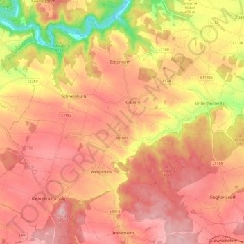
Name: Japons topographic map, elevation, terrain.
Location: Japons, Bezirk Horn, Niederösterreich, 3763, Österreich (48.76491 15.51360 48.82951 15.62853)
Average elevation: 509 m
Minimum elevation: 381 m
Maximum elevation: 575 m