
Brodten topographic map
Interactive map
Click on the map to display elevation.
About this map
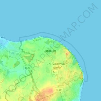
Name: Brodten topographic map, elevation, terrain.
Location: Brodten, Schleswig-Holstein, 23570, Deutschland (53.96799 10.84187 54.00799 10.88187)
Average elevation: 7 m
Minimum elevation: -2 m
Maximum elevation: 31 m