Geolocate

Seguil topographic map

Click on the map to display elevation.

About this map

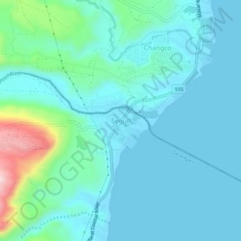
Name: Seguil topographic map, elevation, terrain.

Location: Seguil, Sarangani, Soccsksargen, 9502, Philippines (5.93717 125.07873 5.97717 125.11873)

Average elevation: 56 m

Minimum elevation: 0 m

Maximum elevation: 351 m

Other topographic maps

Click on a map to view its topography, its elevation and its terrain.

Mainit River

Philippines > Sarangani

Average elevation: 279 m

Malungon

Philippines > Sarangani

Average elevation: 464 m

Glan River

Philippines > Sarangani

Average elevation: 384 m

Sarangani Bay

Philippines > Sarangani

Average elevation: 103 m

Buayan River

Philippines > Sarangani > Malungon

Average elevation: 149 m

Gumasa Beach

Philippines > Sarangani > Glan

Average elevation: 60 m

Malungon

Philippines > Sarangani

Average elevation: 464 m