
Thank you for supporting this site ❤️
Make a donation
Make a donation
Risør topographic map
Click on the map to display elevation.
Thank you for supporting this site ❤️
Make a donation
Make a donation
About this map
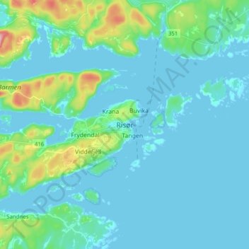
Name: Risør topographic map, elevation, terrain.
Location: Risør, Agder, 4956, Norway (58.68075 9.19438 58.76075 9.27438)
Average elevation: 24 m
Minimum elevation: -1 m
Maximum elevation: 167 m
Thank you for supporting this site ❤️
Make a donation
Make a donation