
Budakalász topographic map
Interactive map
Click on the map to display elevation.
About this map
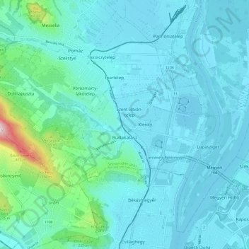
Name: Budakalász topographic map, elevation, terrain.
Location: Budakalász, Szentendrei járás, Pest, Central Hungary, Hungary (47.60582 18.97452 47.64077 19.09172)
Average elevation: 144 m
Minimum elevation: 98 m
Maximum elevation: 480 m
Other topographic maps
Click on a map to view its topography, its elevation and its terrain.
Danube
Hungary > Pest > Budakalász
Danube, Lupasziget, Budakalász, Szentendrei járás, Pest, Central Hungary, 2011, Hungary
Average elevation: 104 m