
Thank you for supporting this site ❤️
Make a donation
Make a donation
La Guibertière topographic map
Click on the map to display elevation.
Thank you for supporting this site ❤️
Make a donation
Make a donation
About this map
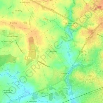
Name: La Guibertière topographic map, elevation, terrain.
Average elevation: 62 m
Minimum elevation: 40 m
Maximum elevation: 80 m
Thank you for supporting this site ❤️
Make a donation
Make a donation
Other topographic maps
Click on a map to view its topography, its elevation and its terrain.
La Potinière
France > Pays de la Loire > Vendée > La Roche-sur-Yon > La Courtille
Average elevation: 53 m