
Kenkere topographic map
Interactive map
Click on the map to display elevation.
About this map
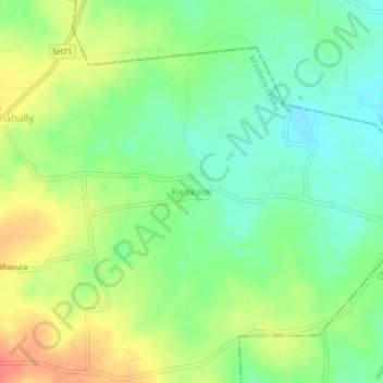
Name: Kenkere topographic map, elevation, terrain.
Location: Kenkere, Arasikere taluku, Hassan district, Karnataka, India (13.15586 76.38661 13.19586 76.42661)
Average elevation: 863 m
Minimum elevation: 839 m
Maximum elevation: 894 m
Other topographic maps
Click on a map to view its topography, its elevation and its terrain.