
Wildemann topographic map
Interactive map
Click on the map to display elevation.
About this map
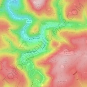
Name: Wildemann topographic map, elevation, terrain.
Average elevation: 500 m
Minimum elevation: 347 m
Maximum elevation: 610 m
Other topographic maps
Click on a map to view its topography, its elevation and its terrain.
Altenau
Duitsland > Nedersaksen > Landkreis Goslar > Clausthal-Zellerfeld
Altenau, Bergstadt Altenau - Schulenberg i.O., Clausthal-Zellerfeld, Landkreis Goslar, Nedersaksen, Duitsland
Average elevation: 599 m