
A Xesta topographic map
Interactive map
Click on the map to display elevation.
About this map
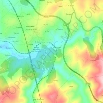
Name: A Xesta topographic map, elevation, terrain.
Location: A Xesta, Lalín, O Deza, Pontevedra, Galicien, 36515, Spanien (42.58777 -8.13121 42.63161 -8.09160)
Average elevation: 568 m
Minimum elevation: 467 m
Maximum elevation: 713 m
Other topographic maps
Click on a map to view its topography, its elevation and its terrain.