
Thank you for supporting this site ❤️
Make a donation
Make a donation
Jay topographic map
Click on the map to display elevation.
Thank you for supporting this site ❤️
Make a donation
Make a donation
About this map
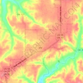
Name: Jay topographic map, elevation, terrain.
Location: Jay, Delaware County, Oklahoma, United States (36.40174 -94.82738 36.45247 -94.77335)
Average elevation: 306 m
Minimum elevation: 255 m
Maximum elevation: 334 m
Thank you for supporting this site ❤️
Make a donation
Make a donation
Other topographic maps
Click on a map to view its topography, its elevation and its terrain.