
Ruente topographic map
Interactive map
Click on the map to display elevation.
About this map
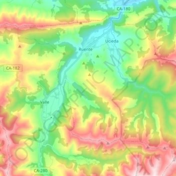
Name: Ruente topographic map, elevation, terrain.
Location: Ruente, Saja-Nansa, Cantabria, Cantabrie, 39513, Espagne (43.19108 -4.32396 43.27898 -4.17698)
Average elevation: 476 m
Minimum elevation: 140 m
Maximum elevation: 984 m