
Redwater Creek topographic map
Interactive map
Click on the map to display elevation.
About this map
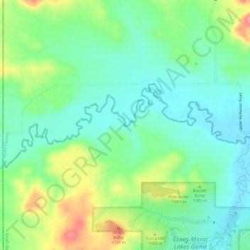
Name: Redwater Creek topographic map, elevation, terrain.
Average elevation: 1,058 m
Minimum elevation: 1,022 m
Maximum elevation: 1,133 m
Other topographic maps
Click on a map to view its topography, its elevation and its terrain.
Nemo
Vereinigte Staaten von Amerika > Süd-Dakota > Lawrence County
Nemo, Lawrence County, Süd-Dakota, Vereinigte Staaten von Amerika
Average elevation: 1,465 m