
Hintersee topographic map
Interactive map
Click on the map to display elevation.
About this map
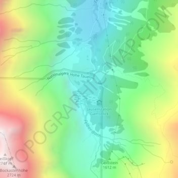
Name: Hintersee topographic map, elevation, terrain.
Average elevation: 1,733 m
Minimum elevation: 1,187 m
Maximum elevation: 2,727 m
Der Hintersee ist ein kleiner Gebirgssee in 1313 m Höhe im Talschluss des Felbertals in Mittersill.
Other topographic maps
Click on a map to view its topography, its elevation and its terrain.
Amertaler See
Österreich > Salzburg > Bezirk Zell am See > Mittersill
Amertaler See, Mittersill, Bezirk Zell am See, Salzburg, 5730, Österreich
Average elevation: 2,426 m
Felben
Österreich > Salzburg > Bezirk Zell am See > Mittersill > Felben
Felben, Mittersill, Bezirk Zell am See, Salzburg, 5730, Österreich
Average elevation: 1,007 m