
Thank you for supporting this site ❤️
Make a donation
Make a donation
Mulabagilu topographic map
Click on the map to display elevation.
Thank you for supporting this site ❤️
Make a donation
Make a donation
Mulabagilu
Mulabagilu is located at 13°10′N 78°24′E / 13.17°N 78.4°E / 13.17; 78.4. It has an average elevation of 827 metres (2,713 feet).
Thank you for supporting this site ❤️
Make a donation
Make a donation
About this map
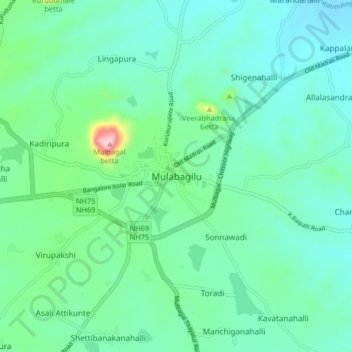
Name: Mulabagilu topographic map, elevation, terrain.
Location: Mulabagilu, Mulubagilu taluk, Kolar, Karnataka, 563131, India (13.12605 78.35272 13.20605 78.43272)
Average elevation: 822 m
Minimum elevation: 757 m
Maximum elevation: 1,091 m
Thank you for supporting this site ❤️
Make a donation
Make a donation