Muquecc Alto topographic map
Click on the map to display elevation.
About this map
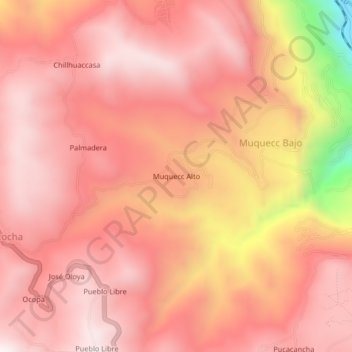
Name: Muquecc Alto topographic map, elevation, terrain.
Average elevation: 3,803 m
Minimum elevation: 3,097 m
Maximum elevation: 4,053 m

Click on the map to display elevation.
Name: Muquecc Alto topographic map, elevation, terrain.
Average elevation: 3,803 m
Minimum elevation: 3,097 m
Maximum elevation: 4,053 m