
Thank you for supporting this site ❤️
Make a donation
Make a donation
Stoke Canon topographic map
Click on the map to display elevation.
Thank you for supporting this site ❤️
Make a donation
Make a donation
About this map
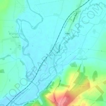
Name: Stoke Canon topographic map, elevation, terrain.
Location: Stoke Canon, East Devon, Devon, England, United Kingdom (50.75716 -3.52078 50.78629 -3.48970)
Average elevation: 35 m
Minimum elevation: 15 m
Maximum elevation: 122 m
Thank you for supporting this site ❤️
Make a donation
Make a donation
Other topographic maps
Click on a map to view its topography, its elevation and its terrain.