
Thank you for supporting this site ❤️
Make a donation
Make a donation
Phetchabun topographic map
Click on the map to display elevation.
Thank you for supporting this site ❤️
Make a donation
Make a donation
About this map
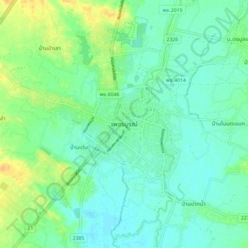
Name: Phetchabun topographic map, elevation, terrain.
Location: Phetchabun, Phetchabun Province, 67000, Thailand (16.37803 101.11568 16.45803 101.19568)
Average elevation: 120 m
Minimum elevation: 110 m
Maximum elevation: 140 m
Thank you for supporting this site ❤️
Make a donation
Make a donation