
Thalaikundah topographic map
Interactive map
Click on the map to display elevation.
About this map
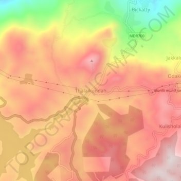
Name: Thalaikundah topographic map, elevation, terrain.
Average elevation: 2,144 m
Minimum elevation: 1,738 m
Maximum elevation: 2,379 m
Other topographic maps
Click on a map to view its topography, its elevation and its terrain.
Government Botanical Garden
India > Tamil Nadu > Udhagamandalam > Udhagamandalam
Average elevation: 2,325 m