
Aviz topographic map
Interactive map
Click on the map to display elevation.
About this map
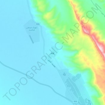
Name: Aviz topographic map, elevation, terrain.
Location: Aviz, بخش مرکزی, Farashband County, Fars Province, Iran (28.87622 52.01721 28.95622 52.09721)
Average elevation: 878 m
Minimum elevation: 766 m
Maximum elevation: 1,472 m
Other topographic maps
Click on a map to view its topography, its elevation and its terrain.
Dehram
Iran > Fars Province > Farashband County > دهستان دهرم
Dehram, دهستان دهرم, بخش دهرم, Farashband County, Fars Province, Iran
Average elevation: 499 m