
Laudachsee topographic map
Interactive map
Click on the map to display elevation.
About this map
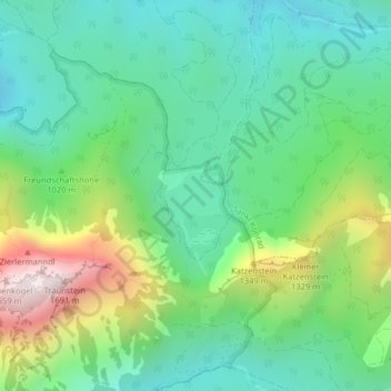
Name: Laudachsee topographic map, elevation, terrain.
Average elevation: 1,009 m
Minimum elevation: 731 m
Maximum elevation: 1,649 m
Other topographic maps
Click on a map to view its topography, its elevation and its terrain.
Traunstein
Österreich > Oberösterreich > Gmunden
Traunstein, Gmunden, Bezirk Gmunden, Oberösterreich, 4810, Österreich
Average elevation: 1,009 m