
Thank you for supporting this site ❤️
Make a donation
Make a donation
Gines topographic map
Click on the map to display elevation.
Thank you for supporting this site ❤️
Make a donation
Make a donation
Gines
Gines is located on the Aljarafe plateau, at an altitude of 123 metres above sea level and about 6 km from Seville (which is almost at sea level). The municipalities closest to Gines are Bormujos, Valencina de la Concepción, Espartinas and Castilleja de la Cuesta, with which it is surrounded, forming a conurbation.
Thank you for supporting this site ❤️
Make a donation
Make a donation
About this map
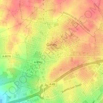
Name: Gines topographic map, elevation, terrain.
Location: Gines, Sevilla, Andalusia, 41960, Spain (37.37631 -6.08805 37.39565 -6.06415)
Average elevation: 114 m
Minimum elevation: 72 m
Maximum elevation: 136 m
Thank you for supporting this site ❤️
Make a donation
Make a donation
Other topographic maps
Click on a map to view its topography, its elevation and its terrain.