
Restedern topographic map
Interactive map
Click on the map to display elevation.
About this map
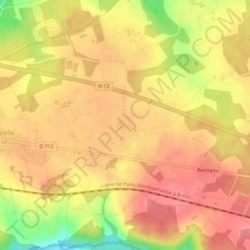
Name: Restedern topographic map, elevation, terrain.
Average elevation: 114 m
Minimum elevation: 62 m
Maximum elevation: 138 m
Other topographic maps
Click on a map to view its topography, its elevation and its terrain.
Lezanafar
France > Bretagne > Plouigneau
Lezanafar, Plouigneau, Morlaix, Finistère, Bretagne, France métropolitaine, 29610, France
Average elevation: 78 m