
Sagbé Sud topographic map
Interactive map
Click on the map to display elevation.
About this map
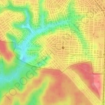
Name: Sagbé Sud topographic map, elevation, terrain.
Location: Sagbé Sud, Abobo, Abidjan, 223, Côte d’Ivoire (5.40503 -4.04456 5.42503 -4.02456)
Average elevation: 102 m
Minimum elevation: 47 m
Maximum elevation: 136 m
Other topographic maps
Click on a map to view its topography, its elevation and its terrain.