
Thank you for supporting this site ❤️
Make a donation
Make a donation
Clearlake topographic map
Click on the map to display elevation.
Thank you for supporting this site ❤️
Make a donation
Make a donation
Clearlake
Clearlake is a city in Lake County, California. Clearlake is 4.5 miles (7.2 km) north-northwest of Lower Lake, at an elevation of 1,417 feet (432 m). As of the 2020 census, the city had a total population of 16,685, up from 15,250 in 2010. It takes its name from Clear Lake.
Thank you for supporting this site ❤️
Make a donation
Make a donation
About this map
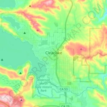
Name: Clearlake topographic map, elevation, terrain.
Location: Clearlake, Lake County, California, United States (38.91983 -122.69956 38.99497 -122.57601)
Average elevation: 474 m
Minimum elevation: 357 m
Maximum elevation: 720 m
Thank you for supporting this site ❤️
Make a donation
Make a donation