
Thank you for supporting this site ❤️
Make a donation
Make a donation
Makku topographic map
Click on the map to display elevation.
Thank you for supporting this site ❤️
Make a donation
Make a donation
About this map
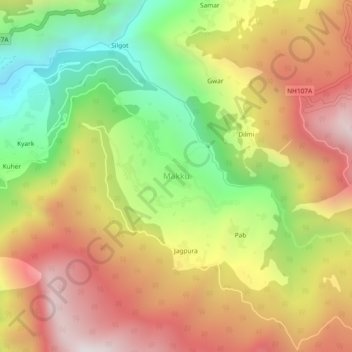
Name: Makku topographic map, elevation, terrain.
Location: Makku, Ukhimath, Rudraprayag, Uttarakhand, 246419, India (30.46134 79.11572 30.50134 79.15572)
Average elevation: 1,841 m
Minimum elevation: 1,135 m
Maximum elevation: 2,509 m
Thank you for supporting this site ❤️
Make a donation
Make a donation
Other topographic maps
Click on a map to view its topography, its elevation and its terrain.