
Perry topographic map
Interactive map
Click on the map to display elevation.
About this map
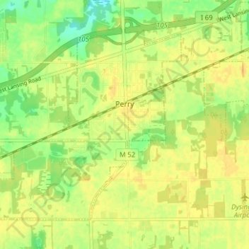
Name: Perry topographic map, elevation, terrain.
Location: Perry, Shiawassee County, Michigan, United States of America (42.80511 -84.26764 42.84004 -84.20523)
Average elevation: 270 m
Minimum elevation: 253 m
Maximum elevation: 279 m