
Thank you for supporting this site ❤️
Make a donation
Make a donation
Ranken topographic map
Click on the map to display elevation.
Thank you for supporting this site ❤️
Make a donation
Make a donation
About this map
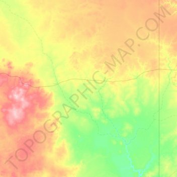
Name: Ranken topographic map, elevation, terrain.
Location: Ranken, Barkly Region, Northern Territory, Australia (-20.89078 136.44096 -19.28830 137.99680)
Average elevation: 241 m
Minimum elevation: 190 m
Maximum elevation: 337 m
Thank you for supporting this site ❤️
Make a donation
Make a donation
Other topographic maps
Click on a map to view its topography, its elevation and its terrain.