
Thank you for supporting this site ❤️
Make a donation
Make a donation
Maripuzha topographic map
Click on the map to display elevation.
Thank you for supporting this site ❤️
Make a donation
Make a donation
About this map
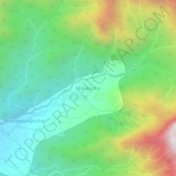
Name: Maripuzha topographic map, elevation, terrain.
Location: Maripuzha, Thamarassery, Kozhikode district, Kerala, India (11.43160 76.08157 11.47160 76.12157)
Average elevation: 935 m
Minimum elevation: 431 m
Maximum elevation: 1,968 m
Thank you for supporting this site ❤️
Make a donation
Make a donation
Other topographic maps
Click on a map to view its topography, its elevation and its terrain.