
Turku topographic map
Interactive map
Click on the map to display elevation.
About this map
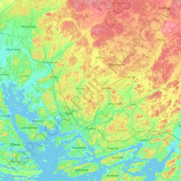
Name: Turku topographic map, elevation, terrain.
Average elevation: 32 m
Minimum elevation: -5 m
Maximum elevation: 95 m
Other topographic maps
Click on a map to view its topography, its elevation and its terrain.
Itäharju
Finland > Southwest Finland > Turku
Itäharju, Nummi-Halinen, Turku, Turku sub-region, Southwest Finland, South-Western Finland, Mainland Finland, Finland
Average elevation: 27 m