
Grace topographic map
Click on the map to display elevation.
About this map
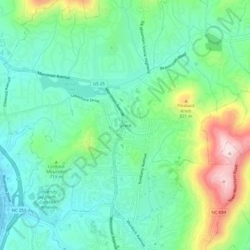
Name: Grace topographic map, elevation, terrain.
Average elevation: 695 m
Minimum elevation: 596 m
Maximum elevation: 939 m
Other topographic maps
Click on a map to view its topography, its elevation and its terrain.
Haw Creek Park
United States > North Carolina > Buncombe County > Asheville > Dogwood Grove
Average elevation: 666 m
Falconhurst-West Asheville Preserve
United States > North Carolina > Buncombe County > Asheville
Average elevation: 647 m