
Finowfurt topographic map
Interactive map
Click on the map to display elevation.
About this map
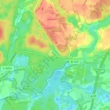
Name: Finowfurt topographic map, elevation, terrain.
Location: Finowfurt, Langer Grund, Barnim, Brandenburg, Deutschland (52.83671 13.62075 52.87671 13.66075)
Average elevation: 43 m
Minimum elevation: 21 m
Maximum elevation: 73 m