
Thank you for supporting this site ❤️
Make a donation
Make a donation
Tintagel topographic map
Click on the map to display elevation.
Thank you for supporting this site ❤️
Make a donation
Make a donation
About this map
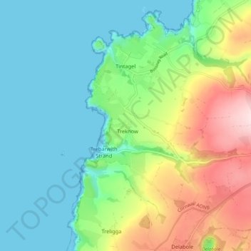
Name: Tintagel topographic map, elevation, terrain.
Location: Tintagel, Cornwall, England, United Kingdom (50.62238 -4.77024 50.67912 -4.69689)
Average elevation: 89 m
Minimum elevation: 0 m
Maximum elevation: 297 m
Thank you for supporting this site ❤️
Make a donation
Make a donation
Other topographic maps
Click on a map to view its topography, its elevation and its terrain.