
Meerut topographic map
Click on the map to display elevation.
About this map
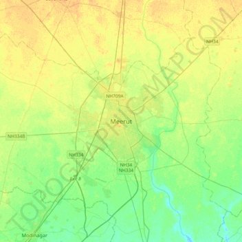
Name: Meerut topographic map, elevation, terrain.
Location: Meerut, Meerut District, Uttar Pradesh, 250003, India (28.82265 77.54810 29.14265 77.86810)
Average elevation: 225 m
Minimum elevation: 214 m
Maximum elevation: 236 m
Other topographic maps
Click on a map to view its topography, its elevation and its terrain.
Mathura District
Mathura is located at 27°17′N 77°25′E / 27.28°N 77.41°E / 27.28; 77.41. It has an average elevation of 174 metres (570 feet). The climate of Mathura is tropical extreme with very hot summers with temperatures rising beyond 44 °C, and cold and foggy winters with the temperature dipping to 5…
Average elevation: 183 m
Jaunpur
The topography of the district is a flat plain undulating with shallow river valleys. The main permanently flowing rivers are the Gomti and the Sai. The rivers of Jaunpur flow from northwest to southeast and the land slopes in the same direction. Thus, there is a more elevated area in the northwest and a less…
Average elevation: 87 m
Sitapur
Sitapur is located at 27.57°N 80.68°E. It test has an average elevation of 138 meters (452 feet). It is located in the Gangetic Plain, with elevations ranging from 150 m above sea level in the north-west to 100 m in the south-east. It is intersected by numerous streams and ravines and contains many shallow…
Average elevation: 131 m
Kanpur
Situated in the flat Indo-Gangetic Plains, Kanpur has an average elevation of 318 m above sea level. The Ganges flows by the city and several ghats are located on its banks, notably the Sati Chaura Ghat and Sarsaiya Ghat. The Brahmavart Ghat located at Bithoor (25 km northwards) is another ghat of religious…
Average elevation: 124 m
Kannauj
Kannauj is located at 27°04′N 79°55′E / 27.07°N 79.92°E / 27.07; 79.92. It has an average elevation of 139 metres (456 feet).
Average elevation: 141 m
Bahraich
Topography: The district's terrain is characterized by a mix of plain and hilly areas. The northern part of the district, bordering Nepal, is mountainous and forms a part of the foothills of the Himalayas. The southern part is predominantly plain, formed by the Gangetic alluvial plains.
Average elevation: 194 m
Agra
The region around Agra consists almost entirely of a level plain, with hills in the extreme southwest. The rivers in the region include Yamuna and Chambal. The region is also watered by the Agra Canal. Millet, barley, wheat and cotton are among the crops grown in the surrounding countryside. Both Rabi and…
Average elevation: 166 m
Barabanki
Barabanki district is for the most part flat agricultural lands studded with groves. The most elevated point is about 130 metres (430 ft) above sea level, and there are few points of view from which any expanse of the countryside can be surveyed. In the north, the topography is broken by a 6.1-metre (20 ft)…
Average elevation: 113 m
Banda
The hills of the district consist of the part of the Vindhyan plateau which lies in the extreme southern portion of the tahsils Mau and Karwi (now known as the district Chitrakut). The northern flank of the Vindhyas known as Vindhyachal range, starts near the Yamuna in the extreme east of tahsil Mau. It…
Average elevation: 137 m