
Mildenberg topographic map
Interactive map
Click on the map to display elevation.
About this map
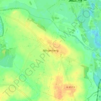
Name: Mildenberg topographic map, elevation, terrain.
Location: Mildenberg, Oberhavel, Brandenburg, 16792, Deutschland (52.98995 13.26941 53.02995 13.30941)
Average elevation: 52 m
Minimum elevation: 38 m
Maximum elevation: 67 m