Geolocate

Spencerville topographic map

Interactive map

Click on the map to display elevation.

About this map

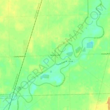
Name: Spencerville topographic map, elevation, terrain.

Location: Spencerville, DeKalb County, Indiana, 46788, United States (41.26311 -84.94191 41.30311 -84.90191)

Average elevation: 249 m

Minimum elevation: 234 m

Maximum elevation: 262 m

Other topographic maps

Click on a map to view its topography, its elevation and its terrain.

Corunna

United States > Indiana > DeKalb County

Corunna, DeKalb County, Indiana, United States

Average elevation: 295 m

Altona

United States > Indiana > DeKalb County

Altona, DeKalb County, Indiana, United States

Average elevation: 271 m

Ashley

United States > Indiana > DeKalb County

Ashley, DeKalb County, Indiana, 46705, United States

Average elevation: 303 m

Butler

United States > Indiana > DeKalb County

Butler, DeKalb County, Indiana, United States

Average elevation: 265 m

St. Joe

United States > Indiana > DeKalb County

St. Joe, DeKalb County, Indiana, United States

Average elevation: 250 m

Waterloo

United States > Indiana > DeKalb County

Waterloo, DeKalb County, Indiana, United States

Average elevation: 276 m

Stafford Center

United States > Indiana > DeKalb County

Stafford Center, DeKalb County, Indiana, 46721, United States

Average elevation: 258 m

Garrett

United States > Indiana > DeKalb County

Garrett, DeKalb County, Indiana, 46738, United States

Average elevation: 270 m