
Thank you for supporting this site ❤️
Make a donation
Make a donation
Banjarnegara topographic map
Click on the map to display elevation.
Thank you for supporting this site ❤️
Make a donation
Make a donation
About this map
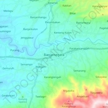
Name: Banjarnegara topographic map, elevation, terrain.
Location: Banjarnegara, 53412, Indonesia (-7.43611 109.65516 -7.35611 109.73516)
Average elevation: 355 m
Minimum elevation: 227 m
Maximum elevation: 873 m
Thank you for supporting this site ❤️
Make a donation
Make a donation