
Una topographic map
Interactive map
Click on the map to display elevation.
About this map
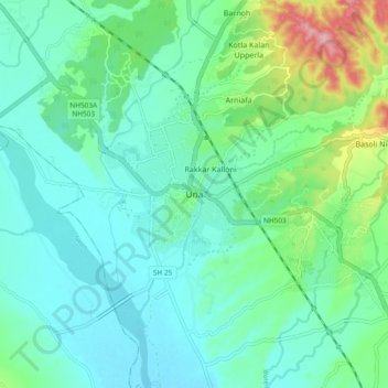
Name: Una topographic map, elevation, terrain.
Location: Una, Himachal Pradesh, 174300, India (31.42749 76.23043 31.50749 76.31043)
Average elevation: 389 m
Minimum elevation: 354 m
Maximum elevation: 515 m