
Tenur topographic map
Interactive map
Click on the map to display elevation.
About this map
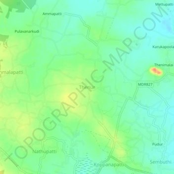
Name: Tenur topographic map, elevation, terrain.
Average elevation: 149 m
Minimum elevation: 132 m
Maximum elevation: 180 m
Other topographic maps
Click on a map to view its topography, its elevation and its terrain.
Tenūr
India > Tamil Nadu > Tenur
Tenūr, Chengalpattu, Chengalpattu district, Tamil Nadu, 603110, India
Average elevation: 57 m