
Thank you for supporting this site ❤️
Make a donation
Make a donation
Amaravati topographic map
Click on the map to display elevation.
Thank you for supporting this site ❤️
Make a donation
Make a donation
About this map
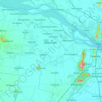
Name: Amaravati topographic map, elevation, terrain.
Location: Amaravati, Thullur, Guntur, Andhra Pradesh, India (16.41376 80.40745 16.57428 80.60546)
Average elevation: 27 m
Minimum elevation: 10 m
Maximum elevation: 255 m
Thank you for supporting this site ❤️
Make a donation
Make a donation
Other topographic maps
Click on a map to view its topography, its elevation and its terrain.
Thank you for supporting this site ❤️
Make a donation
Make a donation
Thank you for supporting this site ❤️
Make a donation
Make a donation