
Cook Island topographic map
Interactive map
Click on the map to display elevation.
About this map
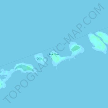
Name: Cook Island topographic map, elevation, terrain.
Location: Cook Island, Comté de Monroe, Floride, États-Unis d'Amérique (24.62753 -81.37780 24.63375 -81.36825)
Average elevation: 0 m
Minimum elevation: -1 m
Maximum elevation: 4 m
Other topographic maps
Click on a map to view its topography, its elevation and its terrain.
Key West
États-Unis d'Amérique > Floride > Comté de Monroe
Key West, Comté de Monroe, Floride, États-Unis d'Amérique
Average elevation: 0 m
Key Largo
États-Unis d'Amérique > Floride > Comté de Monroe
Key Largo, Comté de Monroe, Floride, États-Unis d'Amérique
Average elevation: 1 m