
Thank you for supporting this site ❤️
Make a donation
Make a donation
El Hito topographic map
Click on the map to display elevation.
Thank you for supporting this site ❤️
Make a donation
Make a donation
About this map
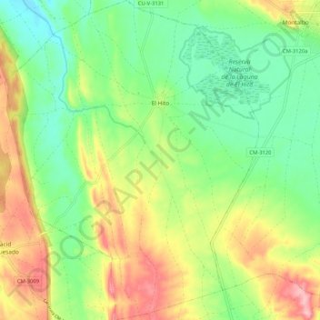
Name: El Hito topographic map, elevation, terrain.
Location: El Hito, Cuenca, Castile-La Mancha, 16441, Spain (39.80492 -2.76555 39.88454 -2.68302)
Average elevation: 864 m
Minimum elevation: 807 m
Maximum elevation: 950 m
Thank you for supporting this site ❤️
Make a donation
Make a donation
Other topographic maps
Click on a map to view its topography, its elevation and its terrain.