
Lonar topographic map
Interactive map
Click on the map to display elevation.
About this map
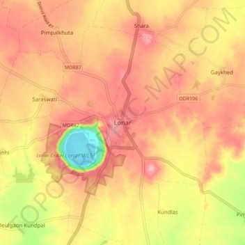
Name: Lonar topographic map, elevation, terrain.
Location: Lonar, Buldhana, Maharashtra, 443302, India (19.94510 76.48270 20.02510 76.56270)
Average elevation: 567 m
Minimum elevation: 475 m
Maximum elevation: 618 m
Other topographic maps
Click on a map to view its topography, its elevation and its terrain.
Lonar Crater
India > Maharashtra > Lonar
Lonar Crater, MDR47, Lonar, Buldhana, Maharashtra, 443302, India
Average elevation: 552 m