
Roustavi topographic map
Interactive map
Click on the map to display elevation.
About this map
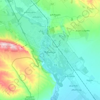
Name: Roustavi topographic map, elevation, terrain.
Location: Roustavi, რუსთავი, Basse Kartlie, 3700, Géorgie (41.49106 44.89030 41.60117 45.08626)
Average elevation: 405 m
Minimum elevation: 298 m
Maximum elevation: 763 m