
Tresgrandas topographic map
Interactive map
Click on the map to display elevation.
About this map
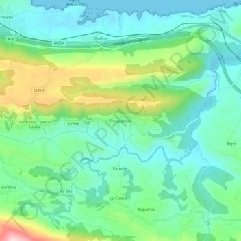
Name: Tresgrandas topographic map, elevation, terrain.
Location: Tresgrandas, Llanes, Asturies, 33590, Espagne (43.35915 -4.63008 43.39915 -4.59008)
Average elevation: 95 m
Minimum elevation: -1 m
Maximum elevation: 345 m
Other topographic maps
Click on a map to view its topography, its elevation and its terrain.