
Sironcha topographic map
Click on the map to display elevation.
Sironcha
Sironcha is located at 18°50′N 79°58′E / 18.83°N 79.96°E / 18.83; 79.96. It has an average elevation of 118 metres (387 ft).
About this map
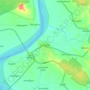
Name: Sironcha topographic map, elevation, terrain.
Location: Sironcha, Sironcha Taluka, Gadchiroli, Maharashtra, India (18.80820 79.92393 18.88820 80.00393)
Average elevation: 115 m
Minimum elevation: 95 m
Maximum elevation: 174 m