
南種子町 topographic map
Interactive map
Click on the map to display elevation.
About this map
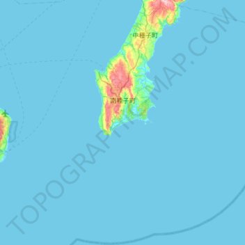
Name: 南種子町 topographic map, elevation, terrain.
Location: 南種子町, 熊毛郡, Prefectura de Kagoshima, 891-3793, Japón (30.14392 130.68777 30.59435 131.21514)
Average elevation: 8 m
Minimum elevation: 0 m
Maximum elevation: 254 m
Other topographic maps
Click on a map to view its topography, its elevation and its terrain.