
Torrelavega topographic map
Interactive map
Click on the map to display elevation.
About this map
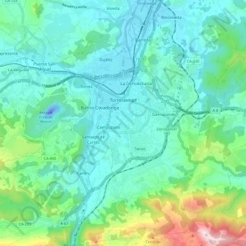
Name: Torrelavega topographic map, elevation, terrain.
Location: Torrelavega, Besaya, Kantabrien, Spanien (43.30014 -4.08185 43.38194 -4.00235)
Average elevation: 119 m
Minimum elevation: -45 m
Maximum elevation: 582 m
Other topographic maps
Click on a map to view its topography, its elevation and its terrain.
Torrelavega
Spanien > Kantabrien > Besaya > Torrelavega > Torrelavega
Torrelavega, Besaya, Kantabrien, 39300, Spanien
Average elevation: 40 m