
Ubon Ratchathani Province topographic map
Interactive map
Click on the map to display elevation.
About this map
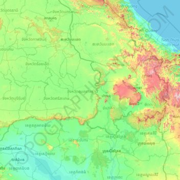
Name: Ubon Ratchathani Province topographic map, elevation, terrain.
Location: Ubon Ratchathani Province, Thailand (12.62797 102.76695 17.74797 107.88695)
Average elevation: 226 m
Minimum elevation: -1 m
Maximum elevation: 2,469 m
Other topographic maps
Click on a map to view its topography, its elevation and its terrain.
Ban Nong Khon
Thailand > Ubon Ratchathani Province > Ban Nong Khon
Ban Nong Khon, Ubon Ratchathani Province, Thailand
Average elevation: 121 m