
Mirabel topographic map
Interactive map
Click on the map to display elevation.
About this map
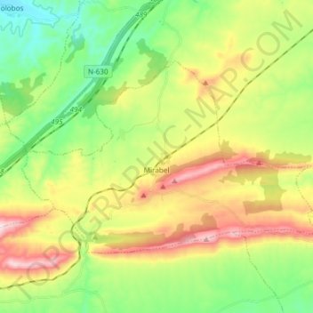
Name: Mirabel topographic map, elevation, terrain.
Location: Mirabel, Cáceres, Estrémadure, 10540, Espagne (39.83119 -6.29806 39.90148 -6.14919)
Average elevation: 450 m
Minimum elevation: 261 m
Maximum elevation: 741 m