
Thank you for supporting this site ❤️
Make a donation
Make a donation
Edmonds topographic map
Click on the map to display elevation.
Thank you for supporting this site ❤️
Make a donation
Make a donation
About this map
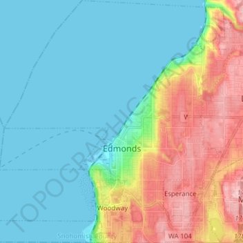
Name: Edmonds topographic map, elevation, terrain.
Location: Edmonds, Snohomish County, Washington, United States (47.77773 -122.43815 47.86162 -122.31941)
Average elevation: 44 m
Minimum elevation: -2 m
Maximum elevation: 152 m
Thank you for supporting this site ❤️
Make a donation
Make a donation
Other topographic maps
Click on a map to view its topography, its elevation and its terrain.